|
home
> Country Charts
|
|
||
|
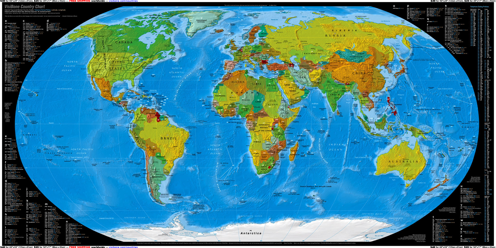
The world's first map of internet country codes. Phone codes too, alphabetic and numeric lists. Look up four ways: code, name, location, or phone. (history). |
“…once again I find myself hypnotized by these maps. :-) ”
– Frank D.
The matte finish has no glare.
The black background The colors are very bold
So why in the world would you need a map like this?
It won't help you phone up .vu "How's the weather down there, Vanuatu? Sorry about that cyclone." It won't stop spam from .il just knowing it claims to come from Israel. Scams from .ng will still do you no good even after you know they're from the country where actor who plays the bad guy in The Matrix was born. It won't stop a war between .tw and .cn, or .pk and .in, or .rw and .bi. It may only help you plan the most preliminary stages of your vacation to .cv or
.mv or
.bv or
.tv where there are no television stations but free internet.
The best reason you don't need to own a VisiBone Country Chart was said by a man who lived many places, Aleksandr Solzhenitsyn:
"Own only what you can carry with you; know language, know countries, know people. Let your memory be your travel bag."
See a HUGE closeup, 740Kb
See a HUMONGOUS and READABLE closeup, 2.8Mb
48-inch × 24-inch
(122cm × 61cm)
larger print
34-inch × 17-inch
(86cm × 43cm)
finer print
is much blacker
in the gloss finish.
in both finishes.
Printed on premium, smudge-resistant, photo paper in stunning color.
Guarantee you'll say wow, or something like it.
“My daughter, Mira, was so excited (we have been looking at the map on the web site)
and the very first thing she did was unfurl the map and study the map on the family room floor.
We have the standard globes but I've never seen her so enthusiastically learning where different countries are located.
The map is perfect. Your choice of colors is very pleasing to the eye.”
– Nihal M.
Excerpts:
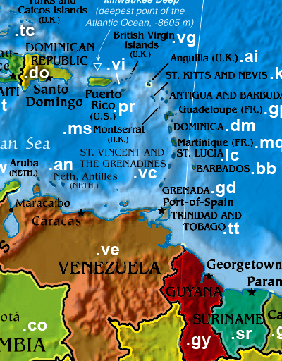
The eastern West Indies of the Caribbean
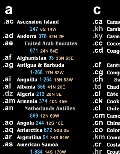
I believe this is the first map with all two-letter ".de" internet country codes.
IANA calls them Top-Level Domain Country Codes, or ccTLD's.
Look up fast. By name. By code.
“Even my girlfriend likes the country chart!
You can quote me on this!”
– Thomas R.
It's also the only map I've seen that's both political and physical showing relief of the oceans.
Did I overdo it? Moi? If you think so, I'll be glad to refund your return.
That is, if you can stand to take it off your wall.
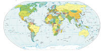
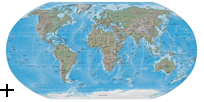
The first step in making this map was to combine two maps from the
CIA World Factbook
:
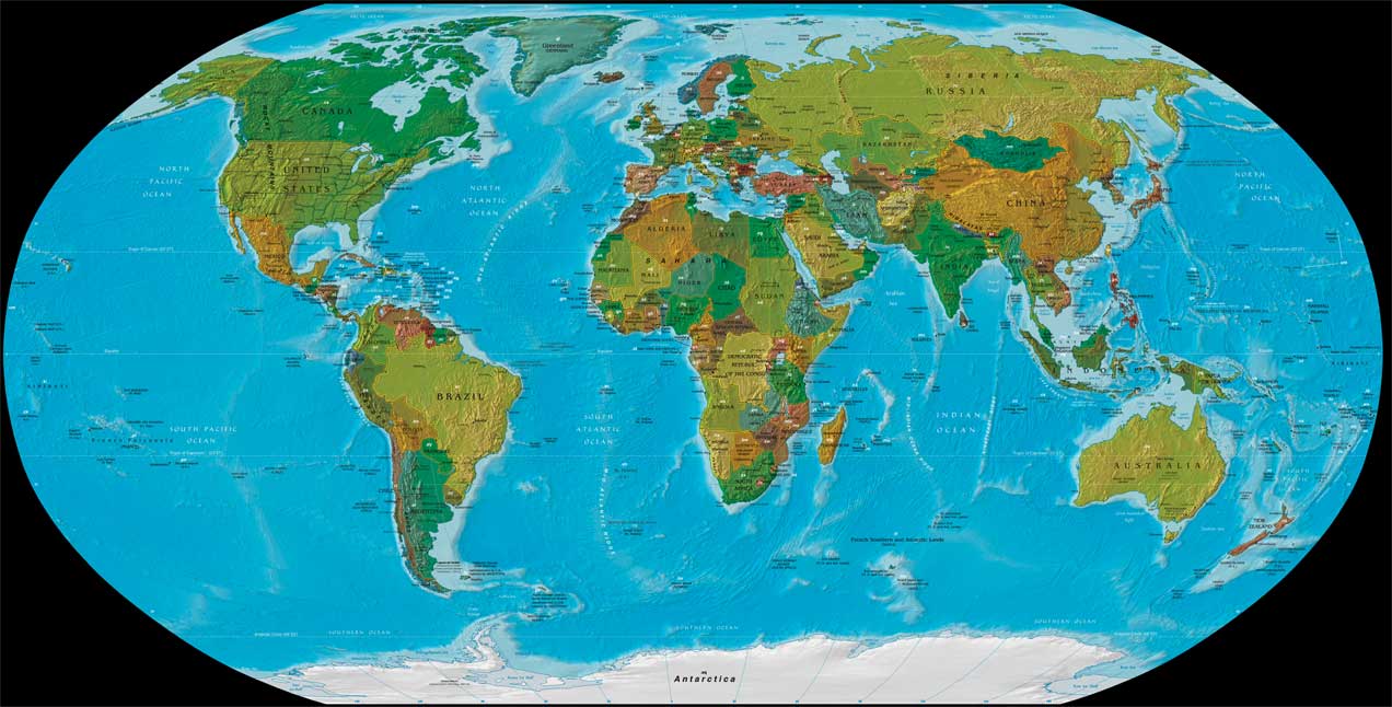
I added the 2-letter codes and the tables and fiddled with colors and media and printers to get it looking right.
What you're seeing emerged after hundreds of trials.

Which is one reason I don't mind putting a
high-resolution
version online.
I just know my printout will be better than yours, if you'll pardon the immodesty.
On the subject of permissions, it turns out the CIA never copyrights anything, by law or something.
I thought I'd write anyway; who doesn't deserve common courtesy.
I received a very nice letter from Molly in the Public Affairs office.
They requested only that the CIA be cited as the source and their seal not appear anywhere.
Are these folks cool or what.
I do recommend putting your chart where the lighting is good and you can stand close if you need to.
Direct sun is recommended only with SPF 30. Seriously, don't get them wet. At all.
Speaking of water, here's an interesting pointless statistic.
Notice how the deeper ocean is a deeper blue?
Each dot of ocean ink on the chart corresponds almost exactly to a cubic kilometer of seawater.
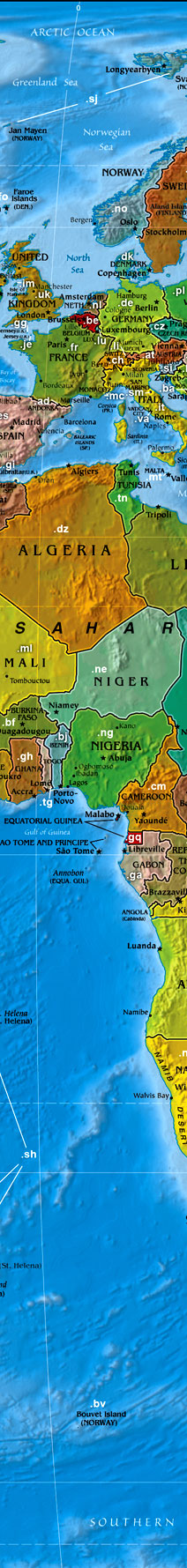
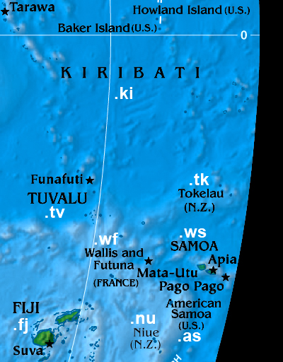
South Pacific island nations
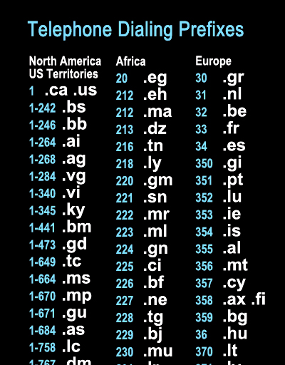
Find countries by their International Telephone Dialing Codes
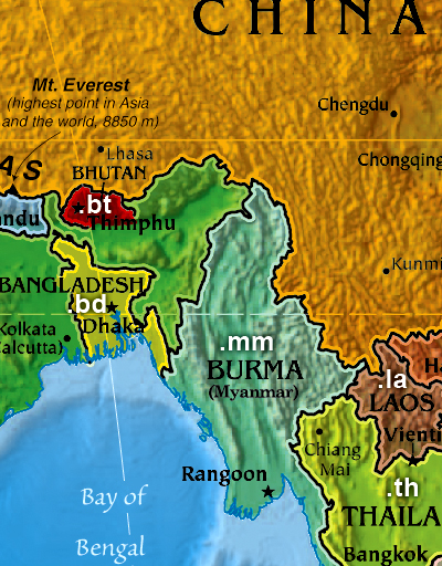
Some places east of Everest